The hardest route of the Bike Festival Marathon is the Ronda Extrema: 83 km, 3.434 meters of difference in height and the overcome of the highest point at an altitude of 1.433 in Prà dei Muci
Leaving the Ronda Grande route at Malga Vigo, the Ronda Extrema continues to Cadregoni, Naone and Duson.
It will be the Adamello glacier that will stop even the most competitive bikers for a moment. Up there, at about 3500 meters of altitude, pages of history have been written related to the war events.
At Malga Valbona there is the highest point of the Ronda to overcome, Prà dei Muci, where on the adjacent ridge, is located the famous “Becco dell’Aquila”. Half of the Ronda is done, the trail passes from Pozza Bella on the same route as the Ronda Grande to Semont where, instead, the Grande continues downhill and the Extrema returns to ask for a last uphill effort to arrive at S. Giovanni’s church.
In Coste starts the downhill to La Selva, Dos del Clef and continues on the same final section of the Ronda Grande to the finish line in Riva del Garda.
The Ronda Grande is recommended for ambitious and advanced bikers.


For more information on routes, bike services (rentals, workshops, shops) and cycling friendly accommodation: Garda Trentino - +39 0464 554444
Safety Tips
This information is subject to inevitable variations, so none of these indications are absolute. It is not entirely possible to avoid giving inexact or imprecise information, given how quickly environmental and weather conditions can change. For this reason, we decline any responsibility for changes which the user may encounter. In any case, it is advisable to check environment and weather conditions before setting out.
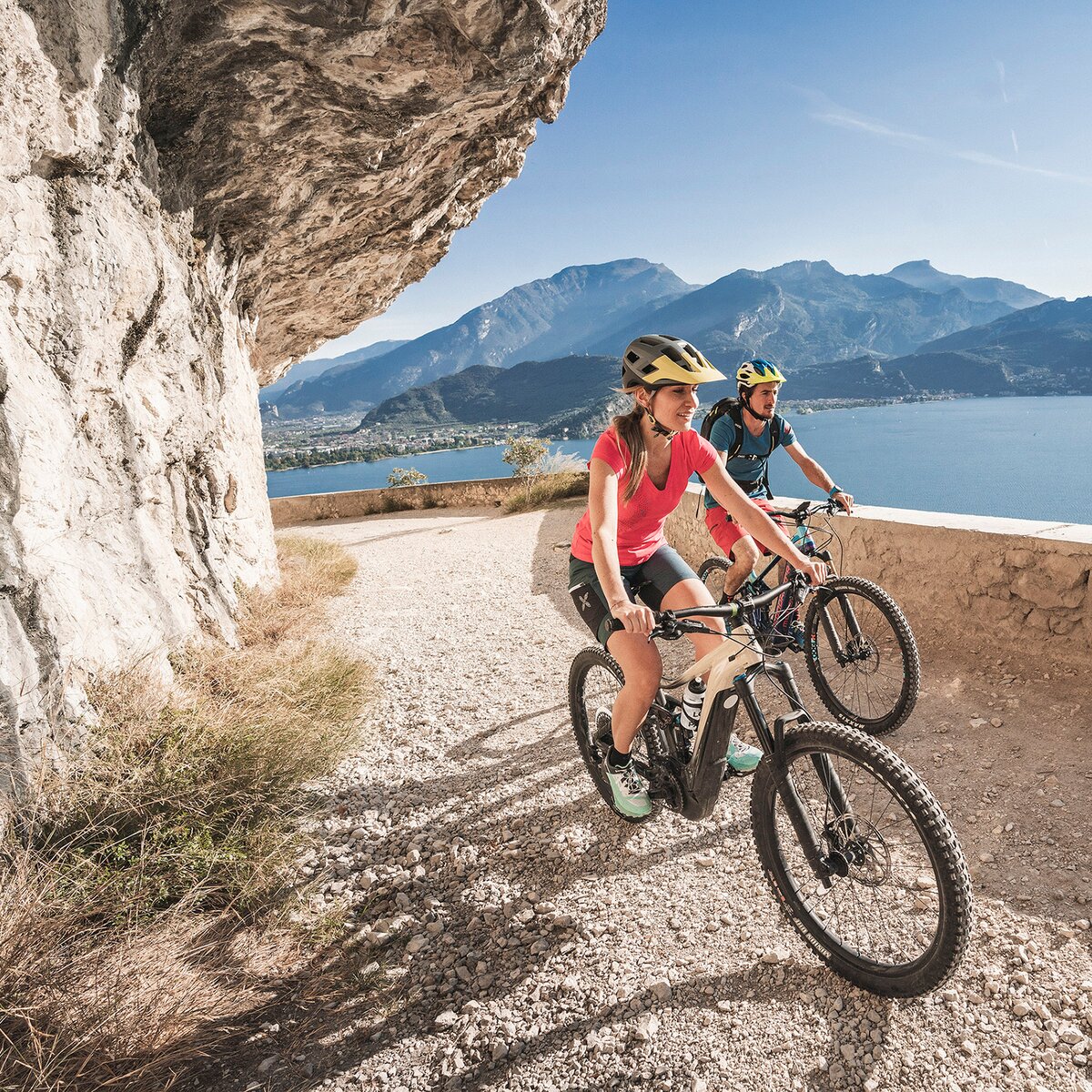
Starting in the heart of the historic center of Riva del Garda, the first kilometers lead through the picturesque areas of Varone, Cologna, and Gavazzo to Tenno. The route then continues on a dirt road to the village of Ville del Monte. From here, the path continues to Lake Tenno, known for its turquoise blue color and unspoiled landscape.
Through the forest road of Terra Rossa and Strada dei Bastiani, the route reaches Monte Calino, where it separates from the Ronda Piccola. The Extrema route takes a dirt road towards Vespana, runs along Lomasona, and reaches Prial. At this point, it's time to shift to a lower gear to tackle the challenging ascent to S. Silvestro. The route continues toward Malga Vigo (1,079 meters above sea level), from where it crosses the archaeological area of S. Martino and enters the beautiful Valdori forest. After 31.5 km at Malga di Vigo, the Ronda Extrema splits from the Ronda Grande, continuing on a dirt road to Cadregoni. From here, a beautiful single trail descends to Naone and then climbs again to Duson.
The Senter de Mez connects Duson with Malga Valbona, the highest point (1,433 meters above sea level) of the Ronda Extrema at Prà dei Muci. At this point, half of the total distance has already been completed. The route then passes through Pozza Bella, following the same path as the Ronda Grande. Continuing towards Semont, the route climbs for the last ascent to the church of S. Giovanni. From Coste, it descends to La Selva, passes in front of Dos del Clef, and then, following the same track as the Grande, climbs again to Bocca di Tovo and then towards Calino. From here, it rejoins the Ronda Piccola route, following the Rancion single track to Località Novino, then returning to Volta di Nò and descending via Varignano to the festival area to cross the finish line.
The main towns in Garda Trentino - Riva del Garda, Arco, Torbole sul Garda, Nago – are connected by several urban and intercity bus lines which will take you to the starting point of tours or in the immediate surroundings.
You can also get to Riva del Garda and Torbole sul Garda by the public ferry service.
Up-to-date information on timetables and routes.
A22 motorway, exit: Rovereto Sud - Lake Garda. Then SS240 in the direction of Riva del Garda.
Find out how to reach Garda Trentino.
Parking near the former hospital (Via Rosmini) or the former cemetery (Viale Damiano Chiesa).
Paid parking: Terme Romane (Viale Roma), Vecchia stazione (Largo Medaglie d’Oro), Ex-agraria (Via Lutti), Area ex-Cattoi (Viale Rovereto).
Riding your bike requires specific clothing and equipment, even for relatively short and easy trips. It is always better to be prepared… e.g. for bad weather or a sudden drop in your energy levels. The unexpected things are part of the fun!
Remember to thoroughly evaluate the type of route you plan on doing, the locations you intend to cross and the current season. Has it been raining? Attention: The paths may be slippery and require more caution.
What do I need to bring on my bike tour?
It is always advised to let someone know where you plan to go and how long you expect to be.
Emergency telephone number 112.


, North Lake Garda Trentino")
, Garda Trentino")
, Garda Trentino")
, Garda Trentino")
, Garda Trentino")